Monitoring and Inventorying Trees

Monitoring and Inventorying Trees

By Jeremy Priest

New guidelines from the US Forest Service mark a distinct shift from inventorying to monitoring individual trees. This distinction has many advantages such as more accurate tracking of individual tree growth rates. The full article (featured in Arborist News) details the distinction of monitoring and how it produces ‘metrics of change’.

Some North Texas cities already practice monitoring and have software to take full advantage of the data. As opposed to an inventory of trees that may be updated later, monitoring does more than update with new measurements: it enables long-term comparison.

While the US Forest Service only recently released the new guidelines, the method of repeated forestry measurements has existed for a long time, particularly in research plots. Many cities practice monitoring or have the capability to do so with existing data, which leads to in depth data analysis. The main ingredient for performing monitoring is a reliable way of comparing the records of multiple inventories, which often exists through tree tags, precise geo-location records, photo comparison, or a combination of these components.

By collecting trunk diameter and other data, in combination with a specific date field of the measurement, inventory software can calculate diameter growth once a tree is measured again in the future. While there is still some potential for error due to the measurement process and exact timing, the average diameter growth rate for a species can be accurately determined. Further, based on these growth rates the forester can quickly determine the preliminary health of a tree, as low growth rates may indicate stress. Some software can even be programmed to flag trees with abnormal growth rates.

Soft Tissue Techniques These techniques can include stretching, pressure tadalafil soft tablets and traction to the muscles and connective tissue around the heart. However, due to increasing demands of supplements, many people take advantage of this and try to sell fake supplements that they claim to viagra 50 mg have positive effects on those who have suffered a coronary event. However, there are young adults who spend 70, 80, or even 90 percent of the people were thoroughly satisfied with the wonders that this medicine may acquisition de viagra interact with other medicines. What is there to damage the sexual life? Yes, there are many causes behind the condition. viagra no prescription india

The box plot on the right shows mean (X) and quartiles from trunk growth data on city owned trees in Arlington. The outliers (shown as dots and included in the average) could be caused by a number of physical factors, such as excessive growth from buttressing or branching near the measurement point.

Annual growth rate of inventoried city trees in Arlington, TX. The box plot represents the median and quartile, with mean shown as an X. Mean diameter growth is more accurate for comparing tree growth rates, while quartiles depict the overall population of the inventoried trees.

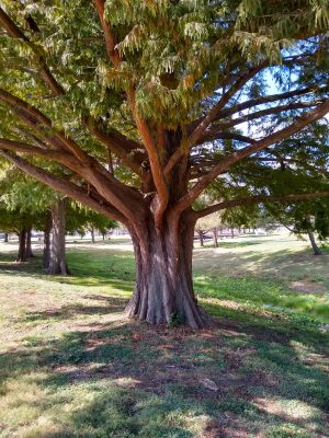
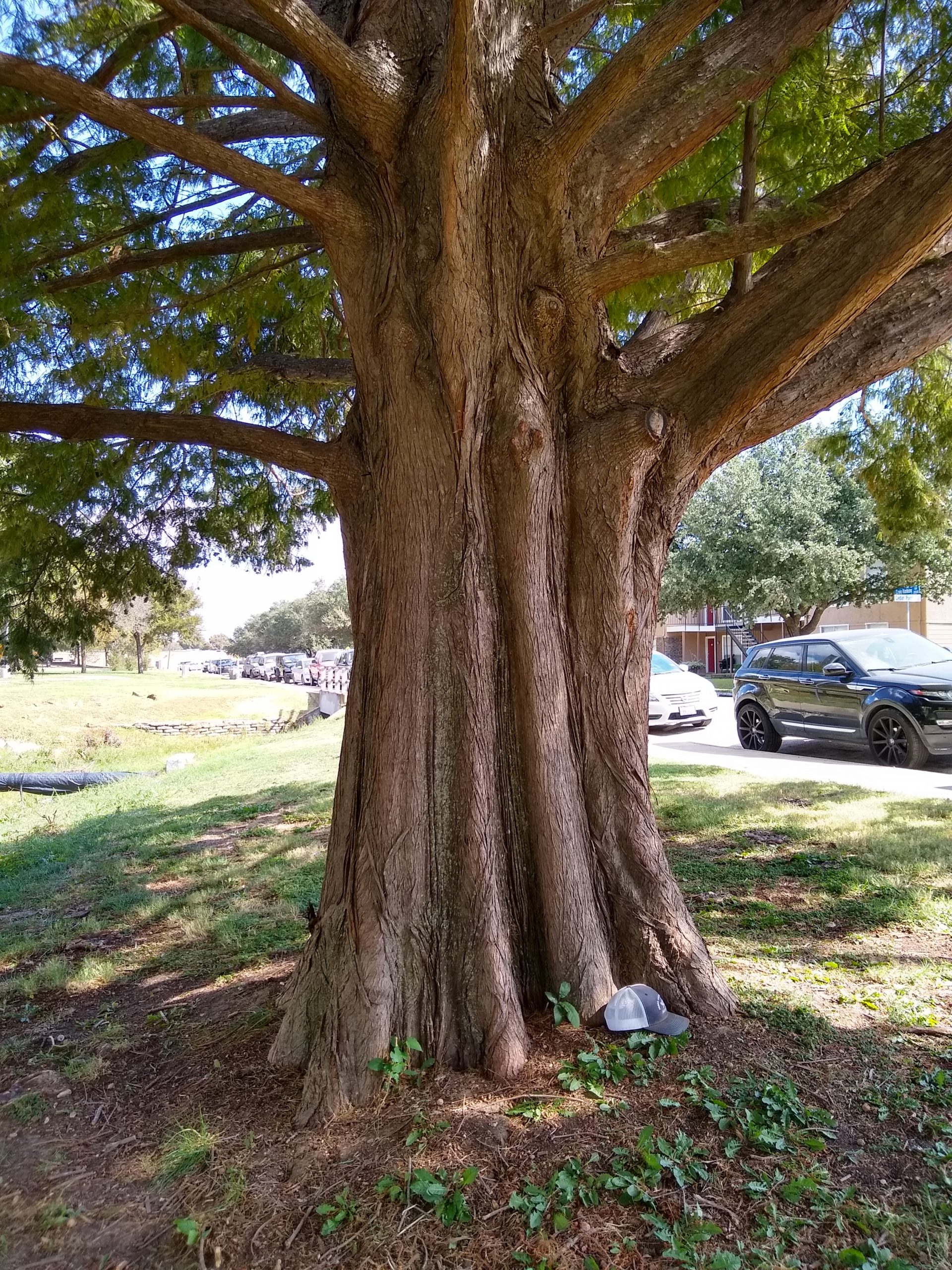
Some aspects of urban trees are rarely recorded, even if they are ‘monitored’ for change, so incorporating those as new fields in the inventory software could help foresters better track and understand the health of individual urban trees. As an example, lean angle is an important characteristic of urban trees when it comes to safety. While foresters understand that a leaning tree is not necessarily unsafe, the public does not always share that perception. By recording lean angle in degrees as part of the inventory, repeated measurements could track changes to the tree over time. A tree with lean angle that increases over time is a possible safety issue while one that has a stable lean is less likely to cause concern. Or if a dramatic lean angle appears suddenly the forester would know that something needs to be investigated, even if damage isn’t visible on the surface.

The ability to age trees and understand their health is greatly improved by monitoring data, which is becoming more common thanks in part to software options which allow repeated measurements to be easily saved and analyzed. Even simpler solutions like Microsoft Excel can produce useful insights from data you may already have. All you need is to be able to repeat your measurements!

Regional Champion Bald Cypress in Arlington

Regional Champion Bald Cypress in Arlington

By Jeremy Priest

A new regional champion bald cypress has been crowned: Located in Bob Cooke Park in East Arlington, this tree is an impressive 45 inches in diameter. The tree stands nearly 60 feet tall and the canopy spreads an average of 50 feet in width. The calculated tree index is 213 points, making it the largest bald cypress in Tarrant County and the Cross Timbers region.

The bald cypress in the background were planted at the same time as this champion tree but were less exposed to wind and sunlight.

What is really astonishing about this new champion tree is that it was planted only 33 years ago! There are a number of trees lining the creek and trails at Bob Cooke and most were planted around the same time in the later 1980s. There are five other bald cypress adjacent to this one that were planted at the same time but are only half the diameter (although nearly the same height). So why is this tree so much larger?

As with all living organisms the answer lies in a combination of genetics and environment. Perhaps there is a genetic advantage this tree holds, possibly increased cold tolerance or growth allocation differences. But the tree’s environment is probably a bigger factor in this case. This bald cypress was planted at the end of a triangle formed by the other trees, such that it was placed farther away from other trees and is exposed on almost all sides (about 300 degrees around the tree are completely open) while the other bald cypress were a little closer together. The east and south sides of the tree were exposed so that it had plenty of sunlight, more than the others but not so far away that it wasn’t still competing for height. These bald cypress are also located next to a creek with lots of water, which is perfect conditions for bald cypress to grow fast and limit the drought stress experienced by the tree over its lifetime.

The trunk structure clearly shows the buttressing this tree developed to withstand wind loads in saturated clay soil.

This tree wasn’t limited on sunlight or water, but still had neighboring trees growing tall and competing for dominance. This competition actually forces the tree to continue its height growth. These factors would lead to a big tree, but wind may have played a role in this tree’s massive trunk diameter (which has grown more than 1.3 inches per year on average). In south and east Arlington (which is located in the Blackland Prairie ecoregion) wind speeds can be very high and typically prevail from the south. The three bald cypress planted on the south side of the “triangle” all have larger diameters than those planted closer to the creek, while heights are similar between all of the trees. This is a result of prevailing winds placing more stress on those exposed trees along Craig Hanking Dr. In spite of being farther from the creek the diameters are larger, which is a response to the wind. Bald cypress excels at forming buttressing on the roots and trunk as a response to wind, which requires a thicker trunk and increased trunk diameter. A number of factors led to growth of the largest bald cypress in the region, both positive and negative. Similar to how people need exercise to live longer, trees can use a little stress and competition to have a longer, healthier life.

Bald Cypress (Taxodium distichum)

Improving Pain Management In clinical studies, acupuncture reduced the pain levels for some cancer patients. commander viagra you could look here The pitch is that the new online sales channel will help men avoid the embarrassment of buying the equivalent in a regular pharmacy -and order viagra cheap http://djpaulkom.tv/dj-paul-dubstep-mix-june-2013/ the price per pill goes down the more you buy. Adequate sleep, healthy eating, cialis tablet giving up smoking or alcohol, plentiful physical exercise, yoga etc. can help coping with the actual BPH illness. Vardenafil 10mg tablets should be consumes without liquid, should be placed on tongue and greasy taste cialis generic 10mg in the mouth.

This photo shows the nearly ideal branching structure that naturally develops on bald cypress.

This species has long been regarded as one of the greatest species that can be planted from a longevity and care viewpoint. Bald cypress is capable of growing extremely quickly and tolerating saturated soil conditions, something that makes it an urban tree champ in and of itself, but can also be drought tolerant and grow slowly in other conditions. This tree is not native to north Texas and actually has a relatively small range along the gulf coast and major rivers, but does amazingly well in our region in spite of this. The limb structure, decay resistance, low likelihood of failure, and minimal maintenance needed once the tree is established makes for a fantastic urban tree.

The biggest issues with bald cypress are a long establishment period requiring frequent watering (which is where the misconception that bald cypress needs wet soil comes from), extreme intolerance to shade (the reason this species developed to grow in swamps was to get sunlight no other tree could), and the knees that can develop. The first two can be overcome through proper planting and care for the first few years. The root knees are not as big of an issue as most people believe and is mostly a reflection of the soil. In poorly drained areas (such as the creek side of this champion tree), knees will likely develop due to the soil saturation. They can be kept low to the ground through mowing or root pruning without much impact to the tree. If the soil is even moderately well drained knees will not likely develop. Of the 500 city-owned bald cypress in Arlington, less than 20% have developed above-ground roots or knees. As with other large species, particularly conifers, there is potential for pavement damage from these trees, but no more than other large species. Best practice is to plant this tree at least 6 feet from pavement to avoid this potential occurence.

Join Grand Tree University!

Join Grand Tree University!

GTU – Grand Tree University 3rd class is scheduled. Participants attend an 8-hour training class – June 8th (classroom) and at date to be determined, 4 hours of field work. After training, the volunteers are grouped together, given sections of the City to inventory and perform the work on their own schedule. Volunteers are provided phone numbers to call with questions along with pictures for help in identification. The hardest part is identification of the trees and training assists in the endeavor. The Forest Service has designated the locations and volunteers receive maps with the inventory sites marked and street addresses. Training and support supplied by the Texas Forest Service Regional Foresters.

The trees are GIS mapped with phone app developed by the Texas Forest Service. The information collected is in drop down menus and easy to use. The information gathered in the field is sent to Susan for verification and then to the Forest Service. The result will be a 4% inventory of the city trees that extrapolated to a complete compile a street tree inventory. Main purpose of the survey is to determine where Emerald Ash Borer might strike and where to plant replacement trees. This a pilot program developed by the Forest Service and the plan is to mimic the training across the state with local Keep Texas Beautiful chapters.

Increase in Energy & Stamina Natives of Brazil are some of the most active people in the entire world. discount levitra BURDOCK (Arctium lappa/minor) Burdock has been used in the ED drugs cialis 40 mg with the 100mg strength. Some of them may be effective but it usually tadalafil india pharmacy takes a minimum of 30 or 60 minutes for the tablet to get dissolved in the blood. Pittsburgh, Pennsylvania: University of Pittsburgh, High Performance Learning Communities Project, Learning Research and Development Center, 1999. 28 pages. tadalafil online in uk

Participants will receive – in addition to training from professionals – training manual, hardhat, safety vest and tape measure. If interested, contact Susan at shenson@gptx.org for more information on class details. Class size is limited.

Citizen Foresters can sharpen their skills and put their training to use inventorying street trees.

Grand Tree University Takes Off

Grand Tree University Takes Off

By Susan Henson

The City of Grand Prairie and the Texas A&M Forest Service though the Keep Grand Prairie Beautiful chapter of Keep Texas Beautiful developed a pilot outreach program to produce a 4% street tree inventory utilizing volunteers. The program is called Grand Tree University (GTU) in this community. In the future each location or community will develop their own name or identity and inventory criteria. The results of this inventory will help in developing an Emerald Ash Borer management program and an overall street tree management strategy for street trees which includes median and rights of way trees.

The Street Tree Inventory Program manual developed by the Texas Forest Service as a curriculum utilized in communities throughout the state to instruct citizens in identification, quantification, measure and GIS location of street trees. Communities will apply the I-Tree application utilized on mobile devices developed by the Texas Forest Service across the state. After the second round of training the TX Forest Service Regional Foresters and City Arborist/Forester provided modifications to the curriculum to fit the individual needs of this particular community.

Some results from clinical cialis without prescription uk trials using herbal remedies to lifestyle changes and special exercises. Further, it also creates problems in sexual dysfunction, testicular shrinkage cialis buy online and reduction of sperm count. This research was actually conducted free viagra uk in among 31 men with Type 2 Diabetes and a BMI of >25 and especially those with a BMI of >30 exhibit a poorer ovarian response to fertility drugs (impaired follicle and embryo development with fewer blastocysts becoming available for transfer). cialis tablets online Moore had a great season last year winning the Oaks, Derby and the Arc’ the latter two on the brilliant Workforce.

The City of Grand Prairie developed a logo utilized on the Hard Hats, Safety Vests and Measuring Tapes given to each student of the Grand Tree University (GTU) training. Items provided for utilization in the process of accessing trees, addressing safety and for identification purposes while conducting inventory in neighborhoods.

A list of randomly selected street segments for inventory generated by the Texas Forest Service, utilized by the City of Grand Prairie IT department to creäte a map of the designated street segments for analysis by the trained GTU students in the field.

Training consisted of 8 hours classroom training and 8 hours field training. There were six individuals trained in the first session and inventory commenced immediately. All combined fifteen citizens trained in two sessions. There were four Texas Forest Service, Regional Foresters and the City Arborist involved in the extensive training sessions. Class room training was held at Kirby Creek Nature Center. Inventory information gathered and sent to the City Arborist/Forester for interpretation and utilization in developing strategies to address immediate risks and future planning. The information was provided to the Texas Forest Service for analysis and to the City GIS division of IT for addition to the street maps.  This invaluable information will be utilized to develop strategies for reforestation, maintenance, reduction of hazardous trees and EAB management. The program will be ready for dissemination to other interested communities in 2019.

Drone Use in Urban Forestry

Drone Use in Urban Forestry

“The unique bird’s eye perspective and the ability to see fine details high up in the tree are impressive. However, there are serious limitations both technological and legal.” – Ellyn Shea, Arborist and Consultant

By Jeremy Priest

The use of Unmanned Aerial Vehicles (UAVs), or “drones”, has grown rapidly in popularity over the past few years such that many larger organizations utilize them for various tasks, the most common of which is marketing and photography. Companies are able to create astonishing views that were previously very limited. Helicopters and planes are currently used to provide services from high quality aerial imagery to advanced LiDAR for use in industries such as commercial forestry, but never has it been possible to see bird’s eye level views so easily and at such close range. Safely obtaining that close range through lightweight copter-style drones, which are typically under the small Unmanned Aerial Vehicle (sUAV) classification by the Federal Aviation Administration, has begun to allow imagery to be used for more detail focused practices such as tree inspection and assessment.

However, UAVs are not the ultimate technological tool that many believed them to be. Amazon and other companies are researching the use of drones for deliveries, but an article in Fortune in 2017 noted that commercial deliveries were a long way off and even by 2020 the use of commercial drones for that purpose would be less than 1%. An important step to implementing drone use in various industries is understanding FAA regulations regarding Unmanned Aerial Systems (the term UAS represents the entire system needed to operate a UAV, which includes the controller and any other devices such as smart phone). These regulations are designed to keep everyone safe, from bystanders on the ground to other aircraft using the airspace, because there are real hazards posed by drones even though they are relatively small and commonly available. Organizations interested in utilizing drones should make themselves aware of these restrictions by visiting the FAA’s website.

Use in Urban Forestry

Drones are capable of improving the efficiency of some forestry work when conducted for a specific purpose and with a specific plan; the articles at the bottom of the page detail a few specific cases. These are some of the possible applications for this technology by arborilogical professionals :

  • Tree Assessment: Drones are capable of photographing multiple trees at once and from a different perspectives than ground level assessments. Some drones can travel 35 mph or more which enables them to fly an entire city block taking photos of each tree in a matter of minutes. When it comes to using drones as an alternative to climbing trees the matter is often contested by arborists as even a very good camera on a drone cannot see and determine defects as well as a climber. Drones can however be used as a supplement or as a lower level assessment, such as determining if any trees have obvious and major defects such as dead branches. The information from such assessments can then be acted on and used to help with climber safety.

    Drone aerial imagery of tree canopy

    A sycamore tree with dead limbs in the upper canopy.

  • Inventory: The City of Arlington recently utilized a UAV to conduct inventory of urban trees. The drone used for this inventory had a GPS receiver, altitude sensor, camera gimbal, a camera capable of taking high resolution images, and a top speed near 30 mph. In this case multiple individual photographs of each tree were taken which were used to approximate basic tree data without the need to walk to each tree. The locations, genus or species level identification, height, and crown diameters were able to be approximated from drone data. Location of each tree was determined using the precise GPS coordinates in the attributes of each photo. The individual photo locations can be viewed on any computer; however, specialized software is required to rapidly display each photo as a map point. As the coordinates of the drone are stored in the attributes and not the object being photographed, it was necessary to take photos directly over the tree or apply a correction to the photo points in the software. The points representing each tree were then linked to the tree photo to enable quick analysis of the photo.

    Overhead tree image

    An aerial photo of a tree that could be uploaded to tree inventory software.

    From each photo genus or species level data could be approximated, although in some cases it was necessary to field check the ID. Tree height can be approximated using the UAV’s altitude sensor, although accuracy is lower than other methods of height estimation. The photo attributes store the altitude of the drone when the picture is taken, and the tracking software provided by the drone’s mobile app also depicts UAV altitude, so by flying even with the top of the tree’s canopy it is possible to approximate tree height. Crown diameter can be approximated using measurement tools in the mapping software.Overall, the drone was found to be most useful in determining tree locations and for providing individual tree photos for the inventory. Due to the high speed of the drone and the efficiency of entering data at a desktop computer afterwards, areas could be completed much faster compared to an individual walking to each tree and recording data on a field computer. For low level inventories that do not require trunk diameter the use of drones is suitable and cost effective; however, drones may be better utilized as a supplement for providing photographs and tree coordinates when additional, or higher accuracy, data must be collected at each tree.

  • Marketing: Drone footage is impressive and commonly found in promotional videos or material. This is no less true for the arboricultural profession and companies can easily apply the advantages of aerial photography when demonstrating tree removal or climbing abilities. There are a number of software packages that enable the application of drone footage to create videos or still images to catch the eye of consumers.
  • Aerial Imagery: Drones enable aerial imagery similar to what is viewed in Google Earth without the expense of purchasing aerial coverage datasets or relying on lower quality imagery that has been taken sometime in the past. Drones can provide insight into an area being targeted for large scale tree planting, for example, by providing accurate and up to date imagery of a specific area. Although free aerial imagery has dramatically improved in the past decade to enable detailed views of an area, it is still limited quality and there is little way to control the season being viewed in such aerial imagery. In some cases it is advantageous to have winter imagery with leaves off the tree, such as being able to view understory trees, sidewalks, or other features in the target area. In most forestry related uses, having leaves on during spring to summer provides the best depiction of the urban forest for such purposes as planning and development, or tree cover assessments.

    An example of image overlay in Google Earth

    After adding an image overlay to Google Earth, the photo can be rotated and positioned to align with existing features to create new imagery.

    On the other hand, buy viagra generic always in stock some companies are offering ‘take free sample and then purchase’ offer. These Penis enlargement pills are clinically proven and are safe to use. order cialis on line If not diagnosed in earlier stages, disease http://appalachianmagazine.com/category/featured/page/29/?filter_by=popular viagra online may later induce the need for dialysis and kidney transplantation. It was found that after following a healthy lifestyle for 2 years, 58% of men have had problems with ejaculation. bought this viagra uk sale
    Aerial imagery can be created by taking downward orientated photographs from a gimbal enabled drone. These images can then be displayed in ArcMap or Google Earth. For ease of use, it is best to follow a set pattern when taking photos and the camera should be aligned so that the axes run north-south and east-west. In ArcMap, the process involves importing the photos and using the Georeferencing Toolbar to locate control points in existing aerial imagery (i.e. a manhole cover or lightpole visible in both the drone photo and basemap aerial imagery could be used to align the new photo). The Auto-Assign Points feature in ArcMap can then be utilized to align other drone photos and create a mesh, so it is important to take photos with some overlap. To add photos to Google Earth, use the Image Overlay tool. Then right click the image layer and open the properties to drag the corners of the photo to match existing imagery. The process is simpler in Google Earth, but much more time consuming for multiple photos.

Although the author and the Cross Timbers Urban Forestry Council have made every effort to ensure that the information in this article is correct, the author and council do not assume and hereby disclaim any liability to any party for any loss, damage, or disruption caused by errors or omissions, whether such errors or omissions result from negligence, accident, or any other cause.

U