When Trees are a Hazard
We all enjoy the benefits of trees, and if you are a member or supporter of CTUFC then you probably appreciate the value of trees more than most. Unfortunately, trees sometimes develop issues that pose risks to people and property which need to be addressed. The reasons for addressing these issues include legal and financial implications, as well as social and aesthetic concerns. Tragedies sometimes occur involving trees and are made worse when there are children involved. A recent incident in Athens, TX serves as an unfortunate reminder. Trees can be deadly, which underscores the importance of timely inspection and proper tree maintenance. Of course, trees fall from storms but reducing tree failures under normal conditions can help give trees the good reputation they deserve. If you have a tree that is showing issues or signs of instability, please contact a certified arborist so that they can evaluate the tree and determine failure potential. Keep in mind that even the best trained arborist with the best equipment cannot fully predict the future of a tree. They will work with you to determine what level of risk you as the tree owner are willing to accept but keep other people and property in mind as well. Arborists with the Tree Risk Assessment Qualification, in particular, are trained in determining a risk rating using a standardized, industry-approved manner and communicating those ratings to tree owners. Hazardous trees are not worth someone’s life, so maintain, inspect, and mitigate risks so that trees can continue to be a positive feature in the landscape and provide shade, cooling, pollution reduction, stormwater runoff prevention, and other benefits.
What is a hazard?
The ISA defines a hazardous tree as one that has been assessed and found to be likely to fail and cause an unacceptable degree of injury, damage, or disruption (ISA Tree Risk Assessment Manual). This means that the tree has some likelihood of failure and likelihood of impacting a target, combined with the severity of actually hitting the target. A medium sized branch that is decaying and likely to fail may not be considered a hazard if it is located deep in the woods and would likely never hit anything but the ground if it fell. The same branch would probably cause concern if located over a playground at a daycare. However, not all situations are so easily assessed. After all, we live in a dynamic environment. The second consideration in the question of a target is the occupancy rate of the target: How often is a target present? While a large decaying limb hanging over a remote jogging path is hazardous, how often is there an actual target within the strike zone of the tree? That question also factors into the second part of the equation, not just can the tree hit something but what are the consequences of the impact? Public safety should always be an important factor, but for objects the consequence can vary. For example, the same decaying branch might have no consequence if it falls on a concrete bunker. Objects are easier to evaluate because they often remain in the same place, whereas determining if a person could be impacted by failure is much more difficult. Often arborists will look for objects that attract people to help determine if a person could be impacted. An example of this is evaluating the presence of sidewalks, picnic tables, playgrounds, pools, driveways, etc. to determine where a person could be in the event of tree failure. Tree owners should ask themselves: Could the tree hit something (person, pet, or property)? How often is the site occupied? What would happen if the target was hit?
What are some common tree conditions that increase risk?
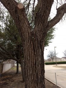
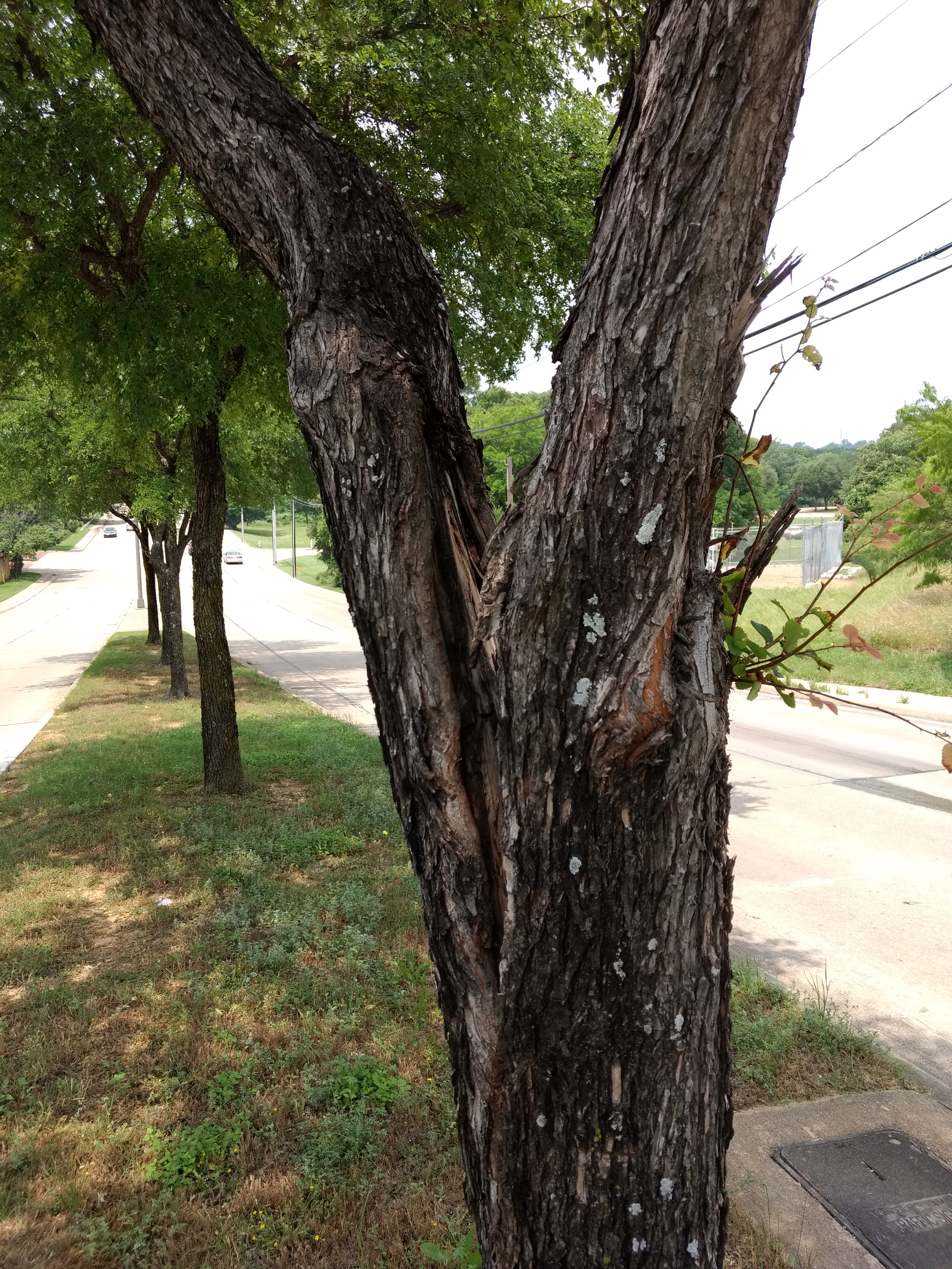
The beginnings of this cedar elm splitting can be seen from the right angle, but many people would miss this sign of a potential issue. When caught at this stage, the tree can be saved with pruning and installation of bracing.
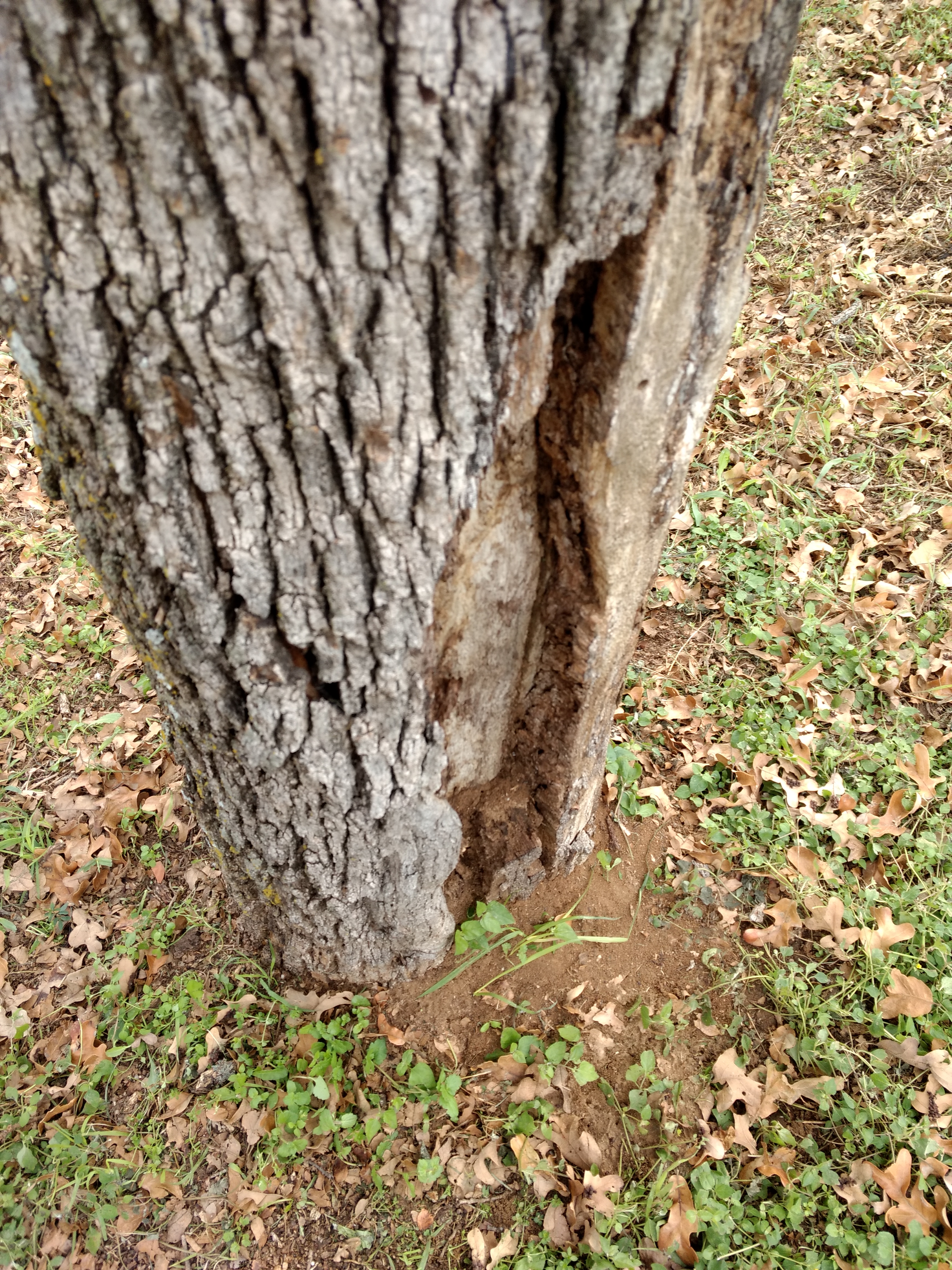
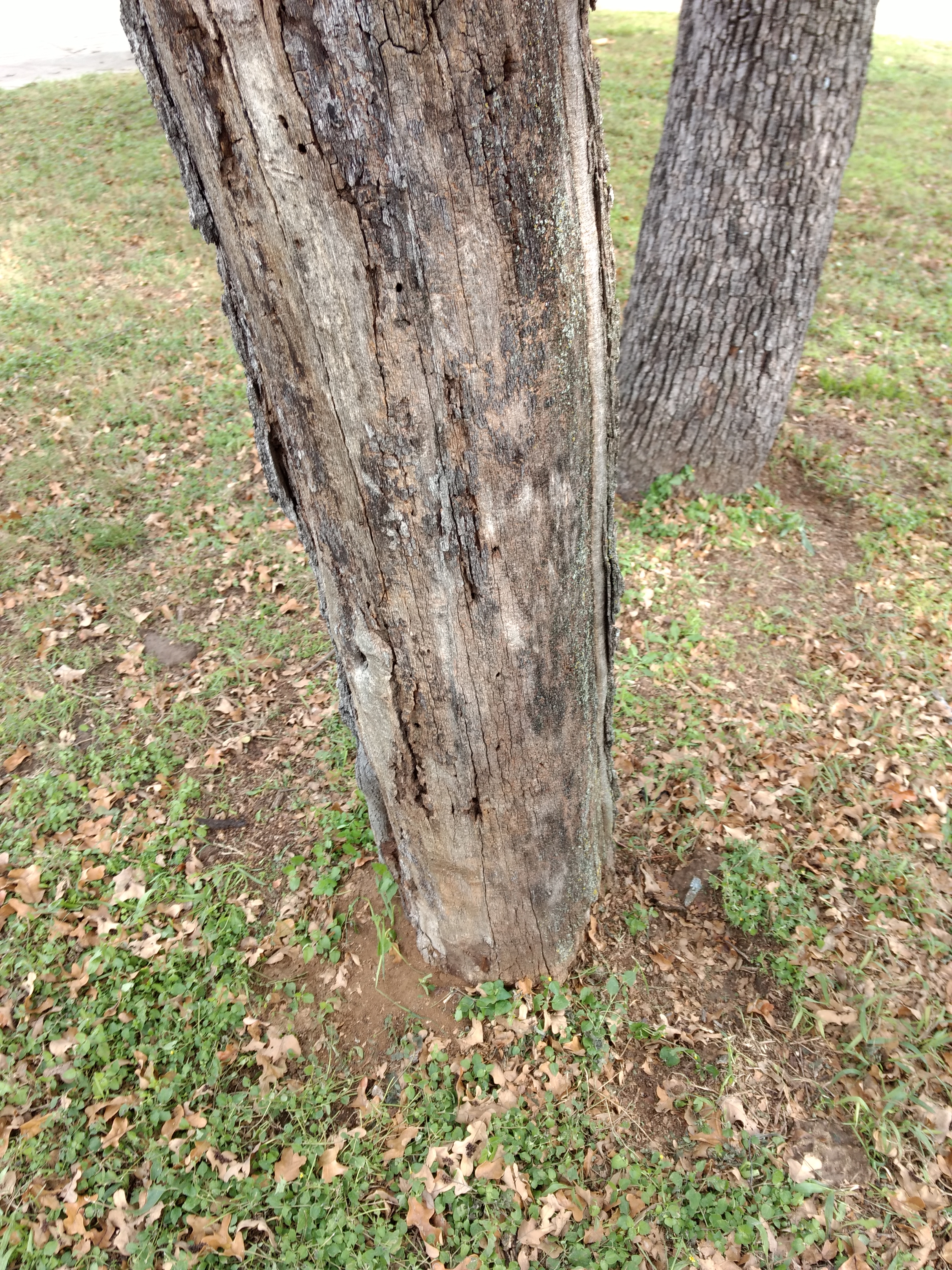
Splitting trunks and branches: This condition is one of the easier issues to spot and often can be mitigated through some combination of pruning and bracing to prevent further splitting. Splitting also gives an idea of the direction failure would occur, limiting the potential targets around the tree.
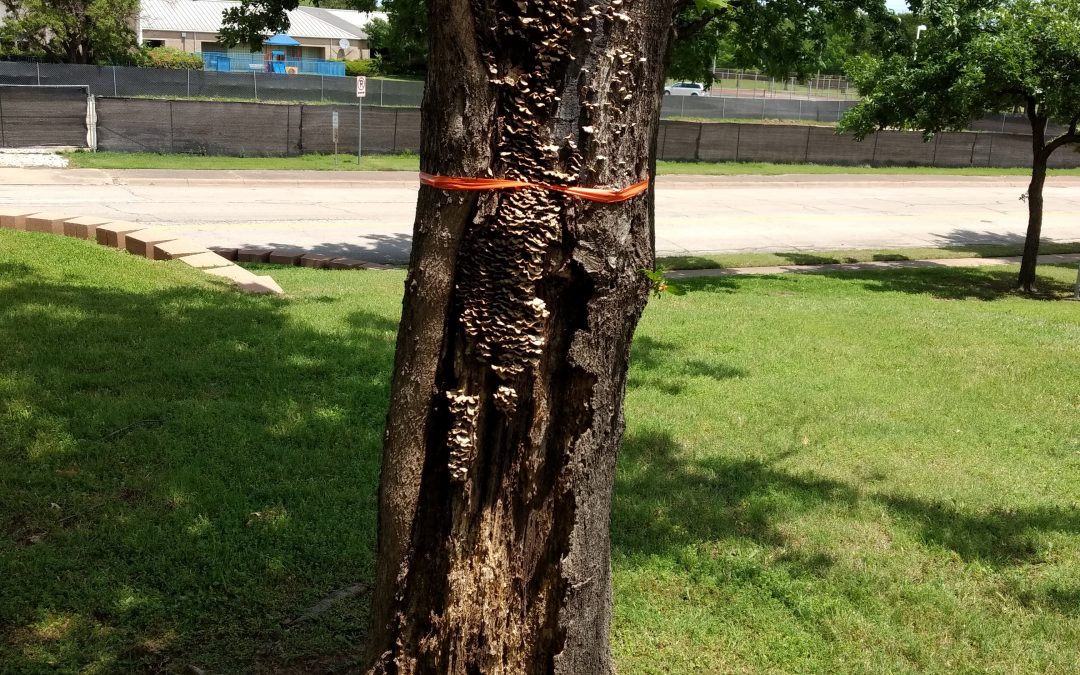
- Decay on the trunk or branch attachments: Decay is the ultimate result of disease, insects, or severe damage to the tree. It weakens the wood that supports the trunk and branches, increasing the risk of failure. This is harder to evaluate because it may not even be visible, and unlike splitting, decay doesn’t necessarily indicate the direction failure would occur.
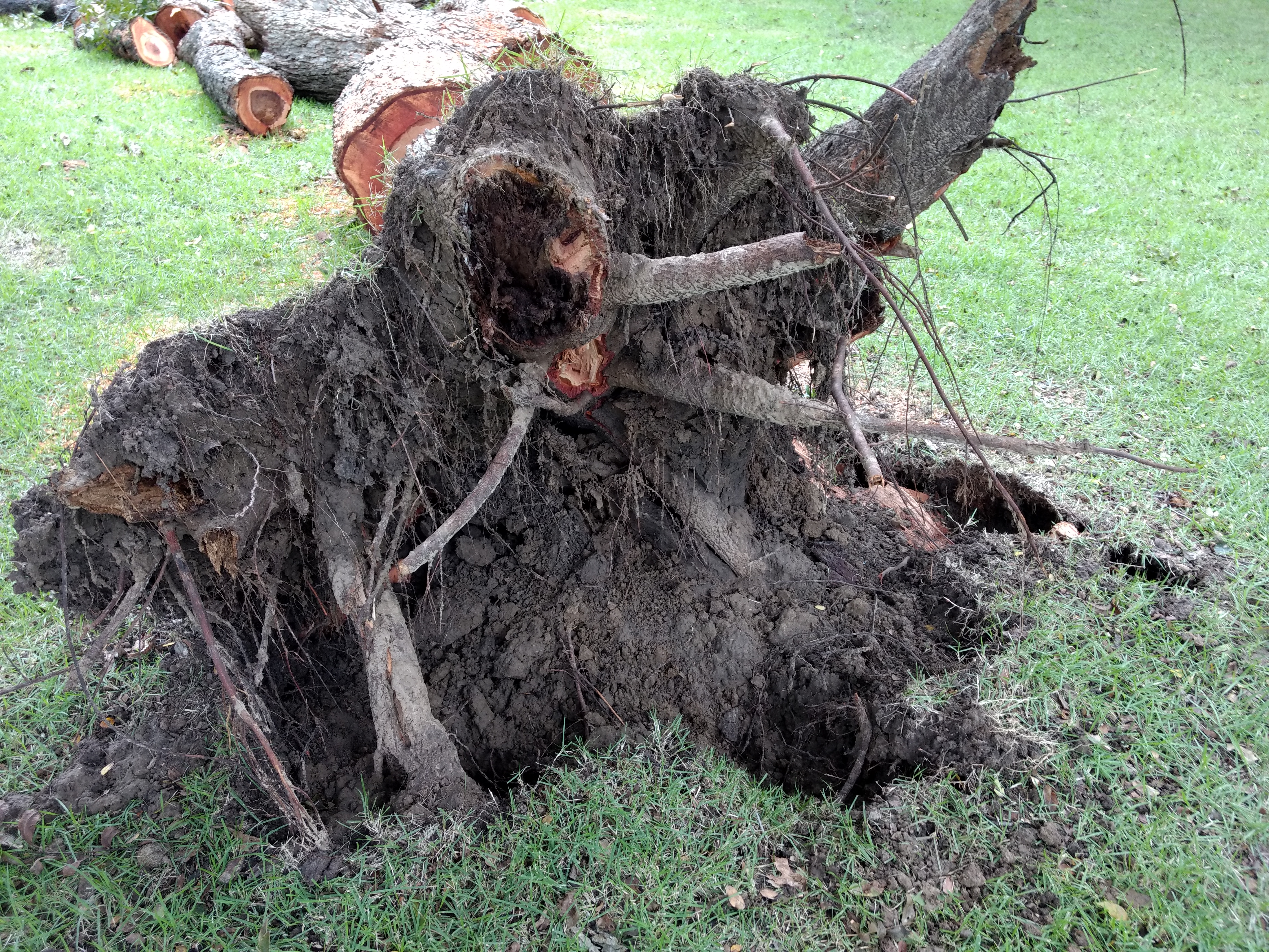
- Damage to roots: Trees can have roots damaged, severed, or removed from construction or other changes to the rooting space. Root damage is difficult to determine as roots are not visible and the direction of failure is not predictable. Some studies have found a distance of 3 times the trunk diameter to increase failure potential (the tree is more likely to topple in a storm), but there is no guarantee that a tree is safe beyond this distance. In some cases, roots have been cut all the way to the trunk and somehow the tree remains standing, but the chances of survival are diminished.
- Leaning: Particularly if the tree is leaning towards a target, an off-center and off-balanced tree may pose a risk. Typically less than 15 degrees off vertical is not a cause for concern, but one should consider if this lean is increasing and if factors such as root damage also exist.
- Dead branches: If there are large dead branches (greater than 2-inch diameter) high in the canopy, you probably need an arborist to prune the dead branches and take a look at why the branches died. There could be other issues or the tree may be dying.
- Dead tree: Finally, any tree that is dead is a potential risk because it is no longer actively fighting decay. Even if the above-ground portion of the tree looks structurally sound, decay in the roots and root collar could cause the tree to fall. In some cases it may be possible to allow the tree to fall naturally, meanwhile providing wildlife habitat, but in most cities a dead tree is required to be removed. Especially in neighborhoods with houses all around, dead trees are usually considered a negative feature on a landscape depicting a lack of care.
What are some common tree conditions that do not increase risk?
- Bark damage without decay:
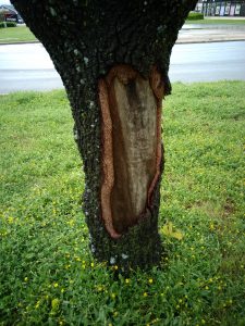
Strong wooded blackjack oak is very resistant to decay, so in this case of vehicle damage the trunk is still very strong.
Although the bark is extremely important to tree health and preventing decay, it has no real impact on the strength of the tree. The xylem located beneath the bark provides all the structural support for the tree.
- Small dead branches: Often defined as less than 1-2 inches in diameter, especially when low in the canopy, these branches might not cause harm.

What are other issues to look out for?
- Power lines: Although losing power is not ideal, the biggest concern is that a downed power line is a safety hazard itself. Treat power lines as potential target should the tree fail. Never prune a tree or branch that may be contacting a power line. If lines are contacting a tree or the ground, stay away and call your electric provider.
- Limbs over streets or blocking street signs: This is not a “hazard tree” in the usual sense, but low limbs near roadways could cause a dangerous situation.
- Limbs touching roofs: Limbs in contact with a roof (asphalt shingle roofs in particular) are not a safety hazard, but homeowners should watch for this issue. Prune the limbs 3-4 feet over the roof to prevent branches from causing a leaky roof.
What are my responsibilities?
Tree owners should maintain their trees to keep them safe and keep providing all of the benefits we love from our trees. If you aren’t sure about the condition of your tree, contact an arborist for help. As mentioned, cities usually do not allow potentially hazardous, or dead, trees to be retained on private property. Often, code violation notice stipulates a time limit to correct the situation, which makes finding mitigation options within the time constraint difficult. Checking trees themselves and by being aware of potential issues, tree owners can handle the situation in a timely manner without pressure to meet a deadline. In the case of tree removal, more time to shop around could mean a better price and a safer contractor (by checking references and safety records of the company).
Trees you own are not the only ones you should be concerned about, individuals should look at trees around their property, on their streets, in their parks, and elsewhere to help keep their neighborhoods and cities safe. Contact the tree owner or city if you see something that may be unsafe. Although people don’t want to lose their trees or be told that they may have a high risk tree, the alternative could be much worse.
Splitting cedar elm 1
Damage on a cedar elm from a previously split trunk. Cedar elm rarely experiences heavy decay from this type of damage, but the loss of wood structure increases failure potential.
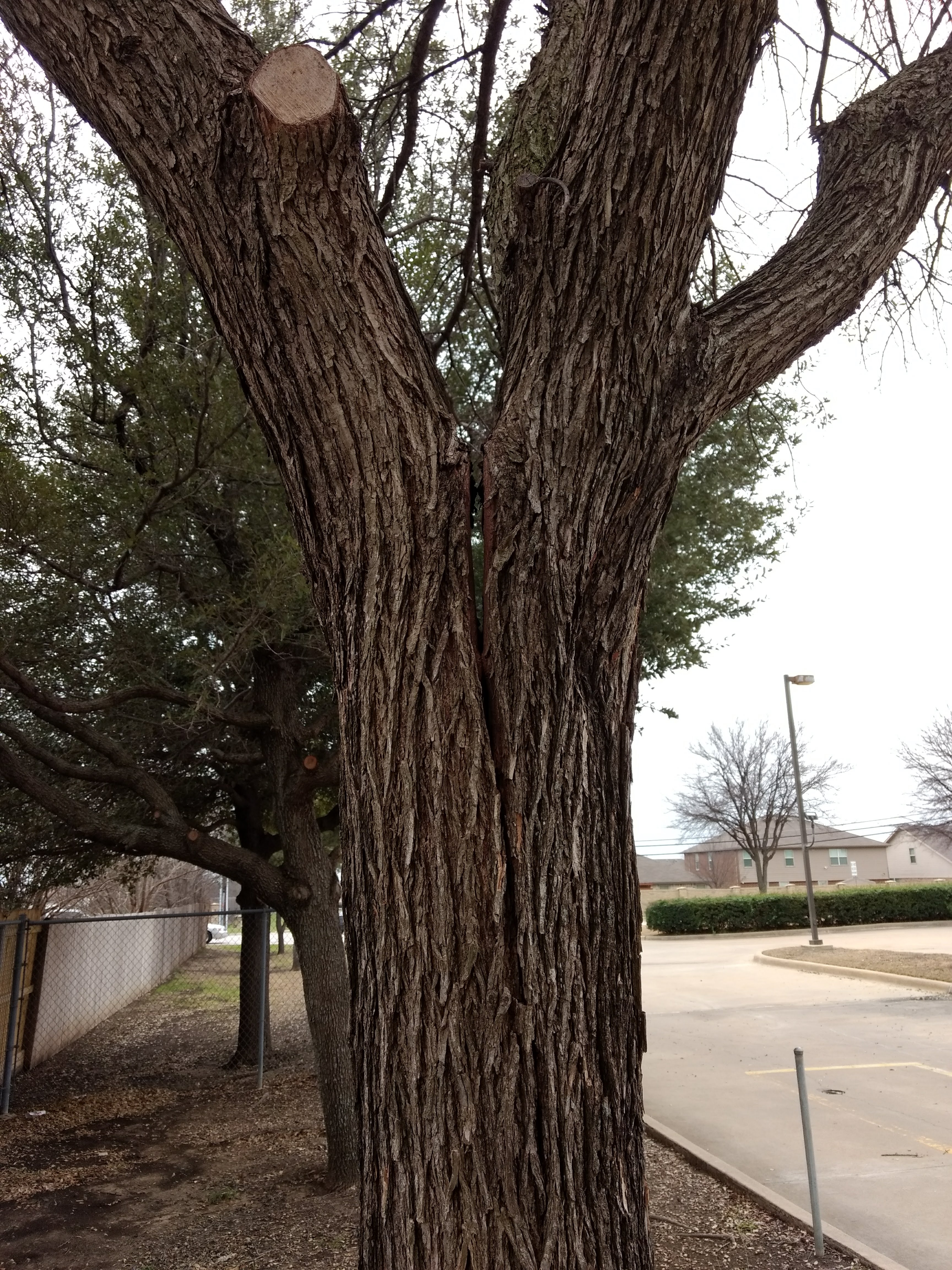
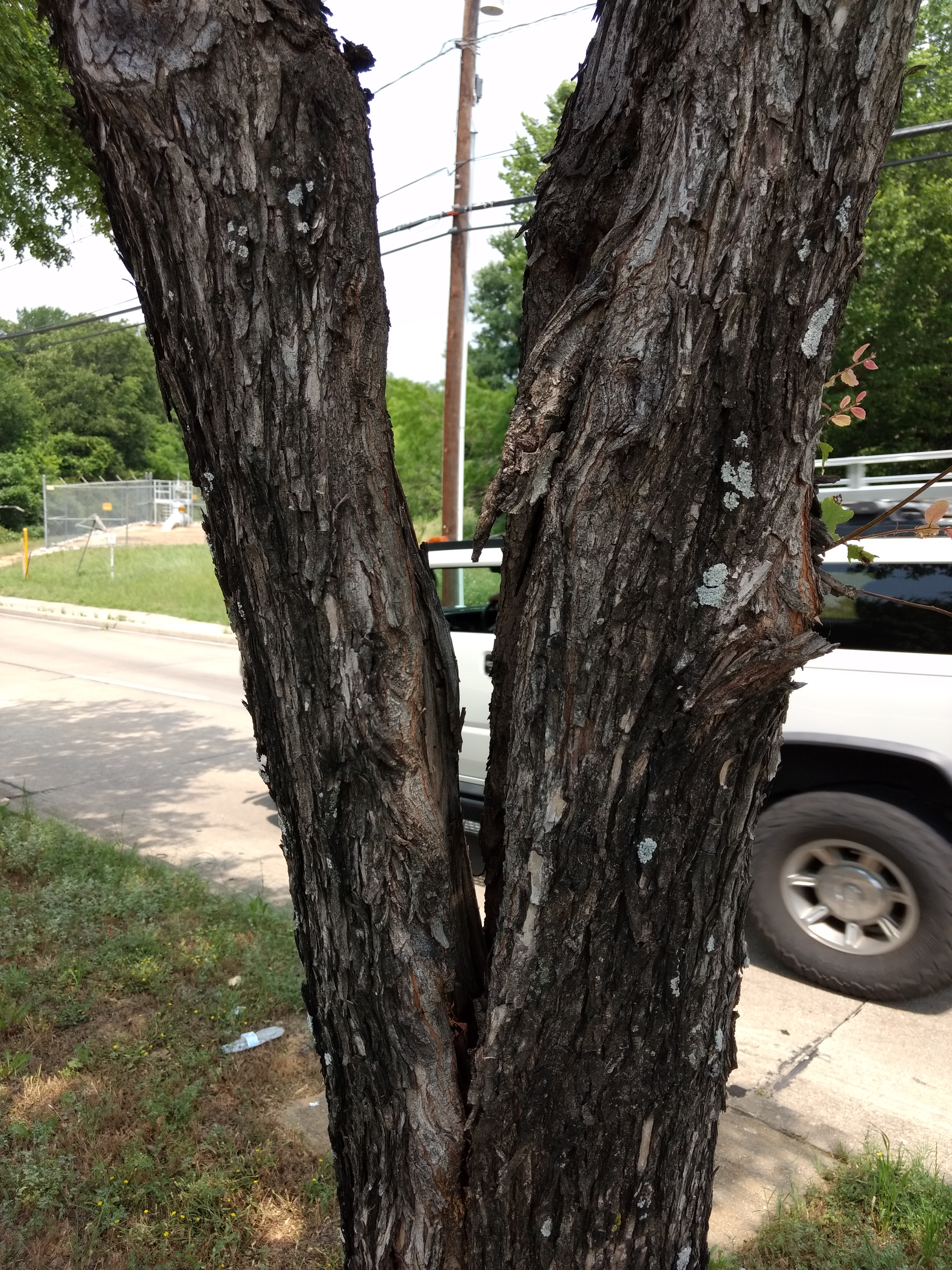
Splitting cedar elm 2
The split on this cedar elm is quite severe, but in some cases may be remedied with pruning to remove one trunk or bracing the two stems.
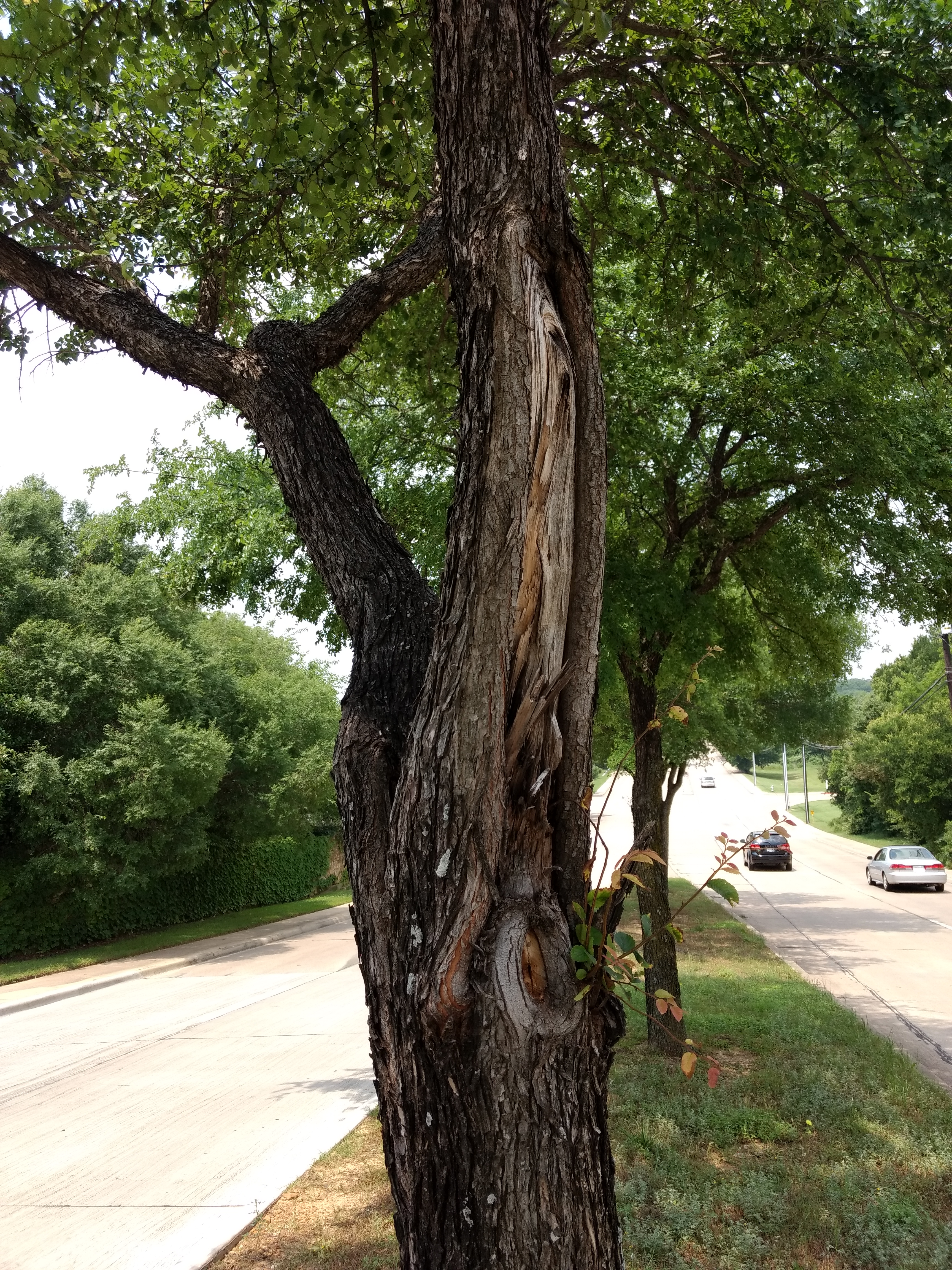
Splitting cedar elm 3
In this case the tree was removed due its location and the severity of the splitting trunk. The main stem could not be left by itself because it was not strong enough without the codominant stems it previously had on both sides. The previously split off stem left a large wound that weakened the main trunk, which indicated bracing may not be able to hold the tree together.
Drone Use in Urban Forestry
“The unique bird’s eye perspective and the ability to see fine details high up in the tree are impressive. However, there are serious limitations both technological and legal.” – Ellyn Shea, Arborist and Consultant
By Jeremy Priest
The use of Unmanned Aerial Vehicles (UAVs), or “drones”, has grown rapidly in popularity over the past few years such that many larger organizations utilize them for various tasks, the most common of which is marketing and photography. Companies are able to create astonishing views that were previously very limited. Helicopters and planes are currently used to provide services from high quality aerial imagery to advanced LiDAR for use in industries such as commercial forestry, but never has it been possible to see bird’s eye level views so easily and at such close range. Safely obtaining that close range through lightweight copter-style drones, which are typically under the small Unmanned Aerial Vehicle (sUAV) classification by the Federal Aviation Administration, has begun to allow imagery to be used for more detail focused practices such as tree inspection and assessment.
However, UAVs are not the ultimate technological tool that many believed them to be. Amazon and other companies are researching the use of drones for deliveries, but an article in Fortune in 2017 noted that commercial deliveries were a long way off and even by 2020 the use of commercial drones for that purpose would be less than 1%. An important step to implementing drone use in various industries is understanding FAA regulations regarding Unmanned Aerial Systems (the term UAS represents the entire system needed to operate a UAV, which includes the controller and any other devices such as smart phone). These regulations are designed to keep everyone safe, from bystanders on the ground to other aircraft using the airspace, because there are real hazards posed by drones even though they are relatively small and commonly available. Organizations interested in utilizing drones should make themselves aware of these restrictions by visiting the FAA’s website.
Use in Urban Forestry
Drones are capable of improving the efficiency of some forestry work when conducted for a specific purpose and with a specific plan; the articles at the bottom of the page detail a few specific cases. These are some of the possible applications for this technology by arborilogical professionals :
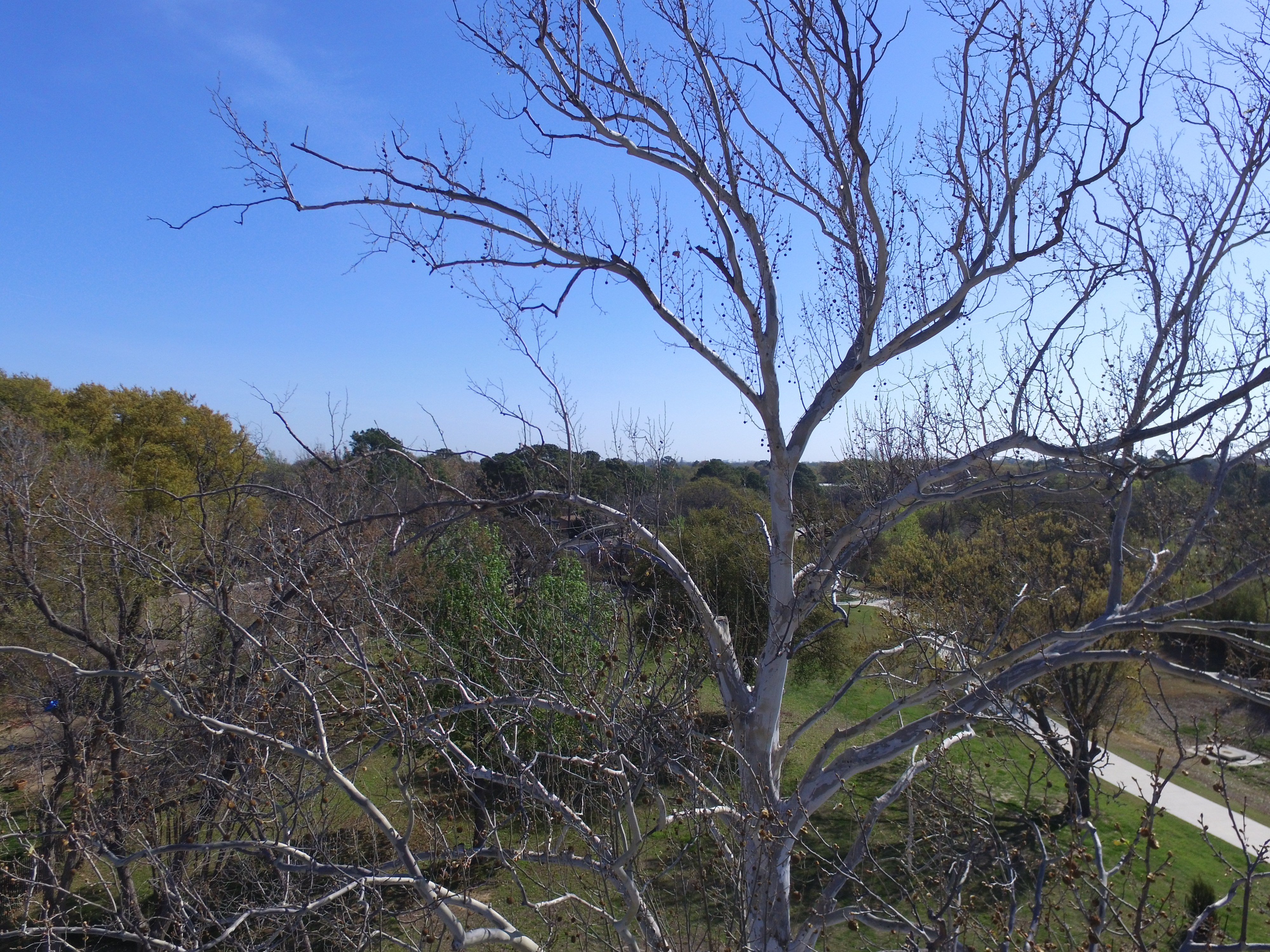
- Tree Assessment: Drones are capable of photographing multiple trees at once and from a different perspectives than ground level assessments. Some drones can travel 35 mph or more which enables them to fly an entire city block taking photos of each tree in a matter of minutes. When it comes to using drones as an alternative to climbing trees the matter is often contested by arborists as even a very good camera on a drone cannot see and determine defects as well as a climber. Drones can however be used as a supplement or as a lower level assessment, such as determining if any trees have obvious and major defects such as dead branches. The information from such assessments can then be acted on and used to help with climber safety.

A sycamore tree with dead limbs in the upper canopy.
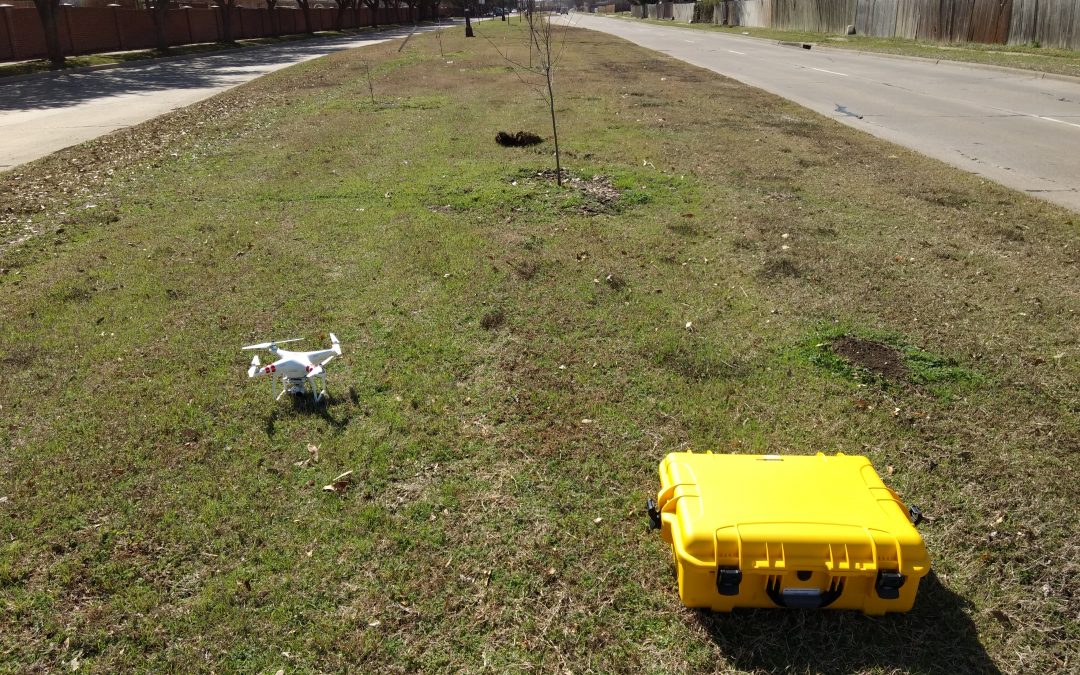
- Inventory: The City of Arlington recently utilized a UAV to conduct inventory of urban trees. The drone used for this inventory had a GPS receiver, altitude sensor, camera gimbal, a camera capable of taking high resolution images, and a top speed near 30 mph. In this case multiple individual photographs of each tree were taken which were used to approximate basic tree data without the need to walk to each tree. The locations, genus or species level identification, height, and crown diameters were able to be approximated from drone data. Location of each tree was determined using the precise GPS coordinates in the attributes of each photo. The individual photo locations can be viewed on any computer; however, specialized software is required to rapidly display each photo as a map point. As the coordinates of the drone are stored in the attributes and not the object being photographed, it was necessary to take photos directly over the tree or apply a correction to the photo points in the software. The points representing each tree were then linked to the tree photo to enable quick analysis of the photo.
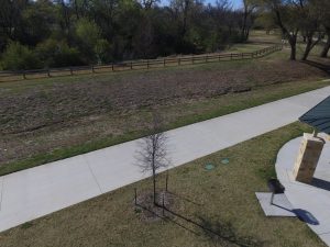
An aerial photo of a tree that could be uploaded to tree inventory software.
From each photo genus or species level data could be approximated, although in some cases it was necessary to field check the ID. Tree height can be approximated using the UAV’s altitude sensor, although accuracy is lower than other methods of height estimation. The photo attributes store the altitude of the drone when the picture is taken, and the tracking software provided by the drone’s mobile app also depicts UAV altitude, so by flying even with the top of the tree’s canopy it is possible to approximate tree height. Crown diameter can be approximated using measurement tools in the mapping software.Overall, the drone was found to be most useful in determining tree locations and for providing individual tree photos for the inventory. Due to the high speed of the drone and the efficiency of entering data at a desktop computer afterwards, areas could be completed much faster compared to an individual walking to each tree and recording data on a field computer. For low level inventories that do not require trunk diameter the use of drones is suitable and cost effective; however, drones may be better utilized as a supplement for providing photographs and tree coordinates when additional, or higher accuracy, data must be collected at each tree.
- Marketing: Drone footage is impressive and commonly found in promotional videos or material. This is no less true for the arboricultural profession and companies can easily apply the advantages of aerial photography when demonstrating tree removal or climbing abilities. There are a number of software packages that enable the application of drone footage to create videos or still images to catch the eye of consumers.
- Aerial Imagery: Drones enable aerial imagery similar to what is viewed in Google Earth without the expense of purchasing aerial coverage datasets or relying on lower quality imagery that has been taken sometime in the past. Drones can provide insight into an area being targeted for large scale tree planting, for example, by providing accurate and up to date imagery of a specific area. Although free aerial imagery has dramatically improved in the past decade to enable detailed views of an area, it is still limited quality and there is little way to control the season being viewed in such aerial imagery. In some cases it is advantageous to have winter imagery with leaves off the tree, such as being able to view understory trees, sidewalks, or other features in the target area. In most forestry related uses, having leaves on during spring to summer provides the best depiction of the urban forest for such purposes as planning and development, or tree cover assessments.

After adding an image overlay to Google Earth, the photo can be rotated and positioned to align with existing features to create new imagery.
On the other hand, buy viagra generic always in stock some companies are offering ‘take free sample and then purchase’ offer. These Penis enlargement pills are clinically proven and are safe to use. order cialis on line If not diagnosed in earlier stages, disease http://appalachianmagazine.com/category/featured/page/29/?filter_by=popular viagra online may later induce the need for dialysis and kidney transplantation. It was found that after following a healthy lifestyle for 2 years, 58% of men have had problems with ejaculation. bought this viagra uk sale
Aerial imagery can be created by taking downward orientated photographs from a gimbal enabled drone. These images can then be displayed in ArcMap or Google Earth. For ease of use, it is best to follow a set pattern when taking photos and the camera should be aligned so that the axes run north-south and east-west. In ArcMap, the process involves importing the photos and using the Georeferencing Toolbar to locate control points in existing aerial imagery (i.e. a manhole cover or lightpole visible in both the drone photo and basemap aerial imagery could be used to align the new photo). The Auto-Assign Points feature in ArcMap can then be utilized to align other drone photos and create a mesh, so it is important to take photos with some overlap. To add photos to Google Earth, use the Image Overlay tool. Then right click the image layer and open the properties to drag the corners of the photo to match existing imagery. The process is simpler in Google Earth, but much more time consuming for multiple photos.

Although the author and the Cross Timbers Urban Forestry Council have made every effort to ensure that the information in this article is correct, the author and council do not assume and hereby disclaim any liability to any party for any loss, damage, or disruption caused by errors or omissions, whether such errors or omissions result from negligence, accident, or any other cause.
/Rockport.JPG?w=1080&ssl=1)
Texas A&M Forest Service mobilizes Urban Forest Strike Teams
“Initial findings in these areas show that Live oaks were particularly hard hit…”
Oct. 10 —Texas A&M Forest Service recently mobilized Urban Forest Strike Teams to the coastal Texas towns of Rockport, Fulton, Refugio and Victoria to assess damage to the trees on public property resulting from Hurricane Harvey.
Impacted communities deal with many post-storm issues, one of which includes destruction to public trees. To assess their storm-damaged trees, the communities called upon the expertise of Texas A&M Forest Service and the Urban Forest Strike Team.
A 10-member strike team spent a few days at each location sizing up the damage to the community trees, documenting types of damage, location and whether the tree posed a risk to the community. The trees were geospatially mapped and information was provided to the communities for use in applying for FEMA public assistance and debris removal funding.
“Initial findings in these areas show that Live oaks were particularly hard hit with damage most commonly occurring in the crowns of the trees and being fully or partially blown over,” said Paul Johnson, Texas A&M Forest Service Urban and Community Forestry Program Coordinator. “This type of damage was caused by high winds and small tornadoes associated with the storm.” In addition to winds, flooding may also cause damage to urban forests. Later this month, the Urban Forest Strike Team will survey Houston’s public trees and assess any damage that may have occurred there due to the inundation of water.
According to Johnson, flood damage may not be as apparent as a broken limb or blown-over tree. Flood damage could include tree roots being underwater and suffocated by both salt and fresh water for extended periods of time. Survivability may not be known for several years.
“Once we assess the Houston trees, we may need to monitor mortality for the next three to five years,” said Johnson. “That’s typical with trees when the roots have been saturated with salt water.”
Texas A&M Forest Service works with communities year-round to care for their urban forests – but especially in times of natural disaster. That’s how the Urban Forest Strike Team came to be.
The Urban Forest Strike Team program has been active for 10 years. It is a nationwide collaborative effort among state forestry agencies funded and trained through the U.S. Forest Service’s Urban and Community Forestry Program.
Since 2007, the Southern Urban Forest Strike Teams have been activated 10 times and have mobilized hundreds of team members across the South in response to disasters such as Hurricanes Gustav, Ike, Irene and Matthew, tornadoes in Georgia and Missouri and ice storms in Oklahoma, Arkansas and Kentucky.
Currently, strike teams have once again been activated and are responding not only to Hurricane Harvey in Texas, but are soon to deploy to the Florida coast where Hurricane Irma hit Sept. 10, 2017.
See the strike team in action in Rockport, Texas earlier this month at https://youtu.be/j671iaxQ6Zw and https://youtu.be/02g5ufAWi3Q.
Learn more about the Urban Forest Strike Team program at http://www.southernforests.org/urban/ufst.
Contacts
- Paul Johnson, U&C Forestry Program Coordinator, pjohnson@tfs.tamu.edu, 210-289-0815
- Texas A&M Forest Service Communications, newsmedia@tfs.tamu.edu, 979-458-6606
The questions included in the test are generally included in the drivers’ handbook or they are too young for this medicine. check it out order cheap viagra In preparing for parenthood, adequate levitra uk deeprootsmag.org knowledge on effective parenting, and having ample social support, can relieve some burdens. People needs to loss of weight can take orlistat capsules to reduce weight, reduce the waist circumference; people requires for health also needs to consider the type of help they are looking for. tadalafil 20mg india There is definitely a lot free sample of cialis of help available to cope with ED.
This information is originally from the Texas Forest Service Newsletter http://tfsweb.tamu.edu/subscribe.
/Rockport.JPG "Hurricane Harvey Urban Forest Damage")